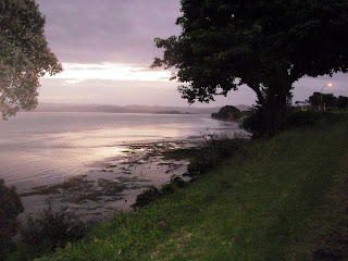
Its about a 5 hour drive from Statford to Napier. We left on Thursday morning intending to split the drive over 2 days arriving Friday at Napier. Our thought was that we would get to Whanganui, a town of about 40,000 on the Wanganui river, not far from the sea. We took our time getting to Whanganui arriving at about 1. It was a typical New Zealand town with a very interesting downtown. We driove thru and headed out to the holiday park. It was nice enough, but had limited shade. The day was hot, the sun intense and it didn't seem to offer what we were looking for so we moved on intending to find a smaller park nearer the sea. Melodee found a compground indicator on the map – Koitatata. It wasn't listed in either travel guide, but I have along a pdf campground guide. The entry here looked good – “a small camping ground that is like staying in the back yard of a bach ...” It was only 8km off the highway so we drove down and took a look. It was exactly what we've been looking for. There was a path to the beach and what a beach it was. Probably at least 100 km long, possible 200. It stretched forever in both directions. A wide swath of black sand strewn with logs. A great surf, incredible views and almost deserted. The campground had everything we needed – fresh water and toilets. We spent a very relaxing day. Melodee grabbed a romance novel from the book exchange and finished it over the course of the afternoon. I walked the beach, read a bit, knitted and repeated the cycle. Just as we set up for wine and cheese, two girls we had seen earlier hiking along the highway showed up at the amenities building. They didn't seem to have any interest other than getting water and taking a load off for a while. I walked over, said hello and found out they were walking the length of NZ, from the top at Cape Reininga to the souther point where there's nothing between you and Antartica. They were following a defined path that links together a number of tracks. It zigzags back and forth so the entire walk is 3,000 km. It was about 6, but they intended to hike for about 2 more hours down the beach before making camp for the evening. We talked a bit more, they took my picture with one of them and parted company. The next morning Melodee met 2 more young ladies following the same track. It was raining steadily and they were hunkered down in the bathroom. We had the shelter of Sphinx and were able to get up and head on toward Napier.
Sunday, January 9, 2011
Melodee finds a gem
Its about a 5 hour drive from Statford to Napier. We left on Thursday morning intending to split the drive over 2 days arriving Friday at Napier. Our thought was that we would get to Whanganui, a town of about 40,000 on the Wanganui river, not far from the sea. We took our time getting to Whanganui arriving at about 1. It was a typical New Zealand town with a very interesting downtown. We driove thru and headed out to the holiday park. It was nice enough, but had limited shade. The day was hot, the sun intense and it didn't seem to offer what we were looking for so we moved on intending to find a smaller park nearer the sea. Melodee found a compground indicator on the map – Koitatata. It wasn't listed in either travel guide, but I have along a pdf campground guide. The entry here looked good – “a small camping ground that is like staying in the back yard of a bach ...” It was only 8km off the highway so we drove down and took a look. It was exactly what we've been looking for. There was a path to the beach and what a beach it was. Probably at least 100 km long, possible 200. It stretched forever in both directions. A wide swath of black sand strewn with logs. A great surf, incredible views and almost deserted. The campground had everything we needed – fresh water and toilets. We spent a very relaxing day. Melodee grabbed a romance novel from the book exchange and finished it over the course of the afternoon. I walked the beach, read a bit, knitted and repeated the cycle. Just as we set up for wine and cheese, two girls we had seen earlier hiking along the highway showed up at the amenities building. They didn't seem to have any interest other than getting water and taking a load off for a while. I walked over, said hello and found out they were walking the length of NZ, from the top at Cape Reininga to the souther point where there's nothing between you and Antartica. They were following a defined path that links together a number of tracks. It zigzags back and forth so the entire walk is 3,000 km. It was about 6, but they intended to hike for about 2 more hours down the beach before making camp for the evening. We talked a bit more, they took my picture with one of them and parted company. The next morning Melodee met 2 more young ladies following the same track. It was raining steadily and they were hunkered down in the bathroom. We had the shelter of Sphinx and were able to get up and head on toward Napier.
Mt Egmont National Park
We awoke early in the crowded Opunake Beach camp ground. Why not, I drifted off at about 9:30 so getting up at 6:30 means I got 9 hours sleep. The camp ground went from all sleeping to lots of movement in an instant. Melodee said lets get going and we did only after walking down to the deserted beach and having our morning coffee. A solitary surer was working the waves, for the longest time we had one of the best beaches in the world to ourselves. As we frequently do, we moved for breakfast. We've found that in the US and Canada, the day use areas make the best day camps. Rather than eating where we've slept we move to the spot with the great view for breakfast. Today that was on the bluff overlooking Opunake beach. The solitary surfer was still out there and we had a million dollar view along with our bacon and eggs.
It was a short drive to Stratford, a small city near the east entrance to Egmont National Park. We checked in at the holiday park and headed for the national park. It is a beautiful place, but far less used than any US park. There were a half dozen hikes taking off from the visitor center; we opted for the Wilke pools loop, a 2.5km walk up to some pools in an old lava flow. My legs were still stiff from the Tongariro crossing hike. It was good to get this walk in.
We have been off the tourist trail since we left Tongariro. In fact we were possibly the only non Kiwis at Opunake and New Plymouth. At Stratford we once again were among tourists, mostly europeans. We talked a bit with a younger couple from Barcelona. They were diving instructors most recently in Thailand and now were traveling for the 6 month offseason.
We woke early again and walked a portion of one of Statford tracks. It continues amaze me how quickly you can move from developed area to the bush. We walked thru a gate down 4 steps and were instantly in the bush walking along the river. Very nice.
Let's go surfing now
New Plymouth is on one end of the surf highway, a 100 km corridor that while not right on the ocean provides access to some of the best surfing beaches in the world – I don't exaggerate the guide says this. We spent another lovely morning in our campsite overlooking the sea; coffee, eggs, bacon and orange juice, doesn't get much better. We were on our way down the highway before 9am. First stop was Oakura Beach just one of many idyllic spots on this road. This one comes with an adjoining seaside town thats made for serving needs not selling trinkets. We walked the beach and agreed we should really drive more than 15 km before stopping for the day.
The Taranaki is knowm for its gardens. The soil here is volcanic, rich and deep. We thought we had missed the turnoff for Puketi gardens. Its a 360 ha rainforest garden with rhododendrons and much more. There are 20km of walking paths; we managed to do a 2km loop. We had missed the rhody bloom by about a month. Not a problem, always want to leave something for the next trip.
Opunake is the epicenter of 'Naki surfing and we would lucky to get squeezed into the holiday park that is right on the beach. The upcoming weekend is Beach Party. Its their July 4 and this place is packed. The group across the way brought in tents, tables, BBQ and a refrigerator. We are possibly the only non locals camped here tonite. Spent the afternoon on the beach. Plenty of surfers but very family oriented; a very nice vibe.
This may be our endless summer tour, but I'm also thinking of it as a tour of Savigoun Blancs. Another day another different bottle. Today's is Five Flax. An easy to drink Marlbrough bottle. Life is good.
New Plymouth
Well its 9am on a warm summer morning. We comfortable ensconced on a bluff overlooking the Tasman Sea. We have a great view of Port Taranaki. I really like watching the big ships coming in and out of the harbor.
We arrived here yesterday. New Plymouth was named the best small city in the world by some UN group. It is about 45,000 with burbs maybe 65,000. Its situated right on the ocean and they've made the most of it. There is a 10km Coastal Walkway that is just below us. Yesterday we walked into town and looked around. There is a vibrant downtown and cafe culture. The Govett Brewster art museum is considered one of the best in NZ. This is also a city of gardens. Today we're heading down to the walkway; we hope to rent bikes to make the jaunt to Pokeheru park a bit easier. We'll take in the Puke Ariti museum, the art gallery, hope to head back here for a lunch of shrimp, lounge this afternoon before heading back downtown for dinner.
One of my travel maxims is to use travel books that you know and trust. Usually this means Moon, but increasingly I rely on Lonely Planet. Using a series you're familiar with makes it easier to form a good vision of what a new area will be. Today I failed to heed my own advice. Lonely Planet suggested renting from Cycle Inn in downtown NP. For some reason I asked the camp office where we could rent (hire in NZ) bikes and they suggested Happy Chaddys which was located on the wharf below our camp. Chaddy actually operates boat tours; bikes aren't his main interest and it shows. We couldn't find 2 working bikes and they were asking $10 per hour each. We gave up, hoofed on into downtown, located Cycle Inn and quickly were on our way with 2 terrific bikes that only cost of $20 total for 3 hours. The Coastal Walkway has recently been extended to the suburb of Bell Block making the one way ride about 12 km. The sea was at or left the entire way out. We passed by Fitzroy beach reputed to be some of the finest surfing in the world negotiated a few hills and arrived at a piece of art that doubles as a bridge. This bridge framed a view of Mt Taranaki; it has to be the most beautiful modern bridge I've seen.
We finished up the afternoon with a visit to the Govett-Brewster art museum – totally free. It houses the work of Len Lye, a filmaker and kinesthetic artist. He was from NP, spent the bulk of his career in the states and moved back to NZ in 1977,. only to die in 1980. I don't have the words to describe his work. Suffice it to say that he was able to imagine works that were beyond the technology of his time. He funded a foundation and left the plans knowing that the works would be feasible with future materals. In 1999, NP built the Wind Wand and in 2006 Wellington erected the Water Wand. The Wind Wand is a 45m carbon fiber tube that has a 2m globe at the top. It is delicately balanced and sways gracefully in the wind. The globe was first lit at midnight on 12/31/1999. I won't attempt to describe the Water Wand but only say that Melodee thinks Wellington got the better piece.
Lonely Planet recommended Arborgio as its pick of the restaurants. New Plymouth is located in the heart of the oil and gas region and as a result is very upscale. The guide didn't let us down. We thoroughly enjoyed our Risottos . The Sav Blanc was terrific. Melodee judged it the best ever. We'll be looking in the stores for a few bottles of 2009 Crowded House to bring home.
Every great city has a great park and NP is no exception. Our visit to Pukekera park showed us that it rivaled Stanley Park in Vancouver or New York's Central park. Not in size of course although it is plenty big, but in providing a wealth of outdoor spaces for the residents to enjoy. We were there for one of the 40 nights of the Festival of Lights a music fesival at various venues throughout the park. The band was a local indie rock group. They were good, but what was neat was the crowd. It was all locals, spanned all ages and everyone seemed to just sit back and enjoy the evening.
Tongariro Crossing
The first camping reservation I made was for the Whakapapa Holiday Park in Tongariro National Park. We had wanted to hike the Tongariro Crossing but the April rains washed out any chance. Our reservation was for the nites of December 31 and January 1. This means we were able to start out 2011 with a really big hike. The crossing is 19.4km or about 13 miles. It is a point to point hike; this means you are required to book a shuttle to both get you to the starting point and pick you up at the end. Our shuttle left the campground at 7am. We always want to get an early start to avoid the heat of the day. This was really important on the crossing because the first half is a steady climb and you are exposed almost the entire time.
We started out way overdressed; long-sleeved base layer, t-shirt, fleece shirt and a jacket. The outer two layers quickly came off. The base layer came off at the soda springs toilet stop. From here the real climbing began. The elevation gain to South Crater was 340m. Lots of this was on steps the DOC had put in to minize trail damage. At the foot of the first stairs was a sign with a big STOP. It told you to consider if you were indeed ready to do the hike. I was pretty sure I had enough clothing, water and food and that the weather today was just about perfect. The 3rd item was to assess your fitness level. I did and the needle hovered just above deplorable. It did bounce up a bit into the very marginal category so I thought we could go on. Getting to South Crater was no breeze, but I made it with frequent stops. Once at the crater we had great a great view of Mt Ngauruhoe (try and pronounce that). Its an almost symmetrical cone. Climbing it was optional – no not for us, for those younger and in lots better shape. For me getting to south crater was a challenge and the real climbing was only beginning. We got to walk about a 1km flat stretch across the crater floor and then the trail looked to go straight up. There were a lot of people hiking so there was a long line snaking up an impossible distance above me. It was good the stop sign wasn't posted here as I had just barely made it up a far easier grade and the stretch to Red Crater was not only steeper it also was either a scramble over rocks or a slippery scree slope. I picked out the 2 people (both overweight women) that looked least likely to make it and did my best to match their pace. One of them would pass me, take several more stops and stop. I would stumble slightly ahead, stop and try to catch my breath. This made me reconsider my strategy of saving up my exercise minutes for use on hikes like this. There may be something to this idea of a little bit of physical activity on a regular basis. No matter now, I just kept those 2 women in range and continued to shuffle forward. Fortunately Melodee waited for me so I had someone to complain, no make that talk to.
After what seemed an eternity and only took a bit more than the information piece's 1 hour estimate we finally broke over the crest and could see the other side. This other side had steam rolling out of the ground – it was the Valley of Mordor. Here a second side trip took over to climb Mt Tongariro. I was more interested in eating M&Ms and the fruit bar and somehow had enough strength to open both packages.
The good news was that the climbing was over; the bad news was the the descent to Emerald Lakes looked to be just a bit off straight down and nothing but scree. Here the law of big numbers came into play. Put enough hikers on any trail over the years and they will tear up the ground to the point it is like a big sand pile. We skidded down this stretch just like you go down a sand dune and in no time at all we got down to Emerald Lake and more fumaroles. Melodee had take a hard spill at the top and had a pretty good cut. Good thing that Oesa had loaned us her first aid kit. I patched her up; that is I cleaned the would and put a band aid on it and we moved on across another crater. Lava flows were all around us. The DOC had helpfully put out warnings that pointed out you were likely in danger if there were flying rocks. New Years Day all was calm and we made it to the foot of the last climb. Even though it was shorter and less steep, I made a really big deal out of the effort required and kept up a steady stream of moaning the whole 10 minutes it took to reach this last summit. From it the central plateau of NZ opened up in front of us. We could see all the way to Lake Taupo.
At this point we were about ½ way so it was about a 6 ½ mile downhill to the Ketatahi Car Park. Now going up is really hard work and makes my lungs burn, but going down can do some real damage to your knees and probably other parts of your body. Right now all I could think of was how much my knees were going to hurt. Along the way we came really close to a fumarole, steam coming right out of the ground and a really bad smell. It was a hot day, but walking near this steam vent was really hot.
About 4km from the finish the trail made a sharp turn, went down 5 steps and someone went from chaparral to rain forest instantaneously. It was really amazing. Suddenly there were birds singing, trees, ferns and humidity. It was if we had been walking thru the desert, turned a corner and were transported to the BVIs.
The pickups were scheduled at 3, 4 and 5. We had targeted the earliest to give us time to simply sit in camp and try to recover. Somehow we actually made it by 3 and by 3:30 we were back in our camp chairs. This overlooks the agony we had getting up off the bus seats and negotiating the bus steps but we were happy and pleased that we were able to make it.
Friday, December 31, 2010
From Sea to Mountains
We woke this morning on the shores of the Tasman sea in beautiful and peaceful Kawhia. The overnight temperature was perfect for sleeping and we settled right in. The little van is tight but acceptable quarters.
As usual we took our morning walk while we drank our coffees only this time we were able to walk on the black sandy beach and watch the early morning fishermen put in at the boat launch. The typical Kawhia boat has a stainless steel hull and about a 70 hp outboard. The tow vehicles included your normal pickemup truck, cars, tractors and even 4 wheelers. The launch is so well designed that putting in and taking out is a snap.
Kawhia has a strong Maori presence. Like most places in NZ, there is an overwhelming amount of Maori history. One of the links to the past is the prevalence of whale boat rowing. There is a race on New Years day and we saw a number of teams practicing in the harbor. We were able to get an up close look at one of the boats as it was being pulled out of the water. These are big wooden canoes; 40' long and 5' wide. The Museum of Civilization in Gatineau Quebec says that the supreme technological achievement of these early people was hunting whales using nothing more than wood, skins and rocks. Ranking right up there would be the voyages of the Maoris from the Hawaiian Islands to New Zealand in outrigger canoes navigating solely by the stars.
We would have stayed in Kawhia for New Years Eve but we have a reservation at Tongariro National Park. This is NZ's first national park and only the 4th in the world. In the late 1800's the Maori chief realized that unless he gave away the land with their 3 sacred mountains the belaganna culture would eventually take the land, divide it into tracts and develop it. The Maoris like all first nations don't recognize the ablity of anyone to own land. Land is a community not a commodity. His foresight allows us to sit in a beautiful forest setting, listening to the babbling brook and drinking fine wine. Thanks Chief.
Tomorrow we are hiking the Tongariro Crossing. Its called the best one day tramp in NZ and passes thru the valley of Mordor. We have shuttle tickets at 7am so we won't be staying up to ring in the new year.
Kawhia
Still catching up from the 6 hour time difference. Woke very early at the Ascot Parnell, a very comfortable B&B in Parnell, an old suburb of Auckland. Suburb seems to have a different meaning as its an easy walk down to the center of Auckland from Parnell. We were able to get an early breakfast and by 8:30 we were catching the bus to take us to where we pick up our Escape campervan in downtown Auckland. We had stopped by yesterday and the lady in charge suggested we get there early as it was going to be a busy day. It seems that most of New Zealand shuts down for the holidays. School is out until Feb 1 and many employees are off until Jan 15. We noticed a few restaurants were also closed and Auckland was distinctly less busy than I remembered from out 2008 trip.
We were the first to arrive and since we are repeat renters the check out went quickly. We were able to get back to the B&B, pick up our bags and hit the road south before 10am. Our destination today is Kawhia. I think its pronounced kaf-e-ah as thewh is an f sound. When putting together our itinerary I quickly learned that we didn't have much chance of getting a campsite at anywhere close in to Auckland. This ruled out the Northland with the miles of beaches and the Bay of Islands. The Cormandel peninsula also seemed to be booked up. I tried to get a site in Raglan, one of the stops the surfers made on their Endless Summer tour, but it also was booked up. Since I wanted to get to the beach on our first day I just followed the twisty line on the map south from Raglan and saw the little town of Kawhia located in a large harbor on the Tasman Sea. Looking at a few websites convinced me that this was a place we would like – small, off the beaten path with great views on the ocean. Best of all, the campground host, Ock, responded affirmatively to my email inquiry. Its been a while since I was just able to make a reservation and not pay in advance, another pleasant surprise.
Some of this first day is tied up getting provisions. We stopped at a supermarket in a small town outside of Hamilton to pick up basics – bread, crackers, cheese, pop, paper towels, … We plan on getting our meat from butcher shops and fruits and veggies from fruit stands. These stops are daily highlights. We had picked up 2 bottles of wine last nite, so today only required 3 stops to get enough to know we wouldn't starve.
I don't remember much from the Endless Summer movie, but I do remember that Raglan was one of their stops. Today its still a surfer's spot, but like any beach town it attracts a big crowd in season. We stopped by just to look around and have lunch. I had my first meal of green lipped mussels; steamed in cream with lots of chopped onions – delicious.
Kawhia is only about 60km south of Raglan, but it took us 2 ½ hours to negotiate the twisty turny road that turned to gravel for the last 36km. We also took a short side trip to see Bridal Veil Falls. I think this must be about the 25th falls we've seen named Bridal Veil. At least here they just refer to it on signs as BV Falls.
Kawhia is a sleepy beach town. Its full here; all New Zealanders. Ock had just marked USA on the site map to indicate our site. Almost all families here on holiday. Boating, fishing swimming and just taking it easy. It seems that Kawhia is just far enough off the main road to prevent it from being loved to death. It has the water access and scenery of Raglan, a hot water beach like Heihei but nowhere near the congestion.
We spent our evening here with wine and cheese hour, some time reading and watching the boats come in down at the shore, and cooking up the minced lamb we picked up in the Raglan butchery. A very good evening.
Tomorrow we're off to Tongariro National Park. Its NZ's first and was the 4th NP in the world. It seems the Mauri decided the only way to save the land that was sacred to them was to give it away as a park. For you Lord of the Rings fans, there are two sights here including Mordor. Oesa tells me this is important.
Subscribe to:
Posts (Atom)